Your stop on the map
The Moreton Bay islands compared: Moreton, Straddie and Bribie
Fast answer
The Moreton Bay islands include Moreton Island, North Stradbroke Island, Bribie Island and the southern bay islands such as Macleay, Lamb, Karragarra, Russell and Peel.
Island facts
Find out about 25 stops
Moreton Bay, the island and the Tangalooma shore, pin by pin
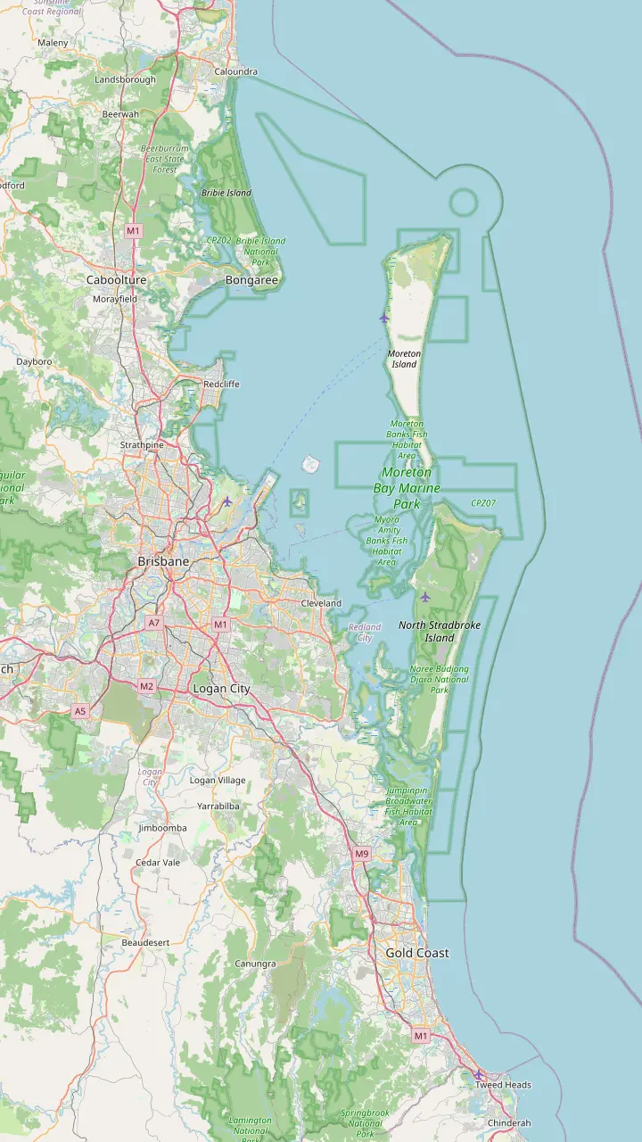
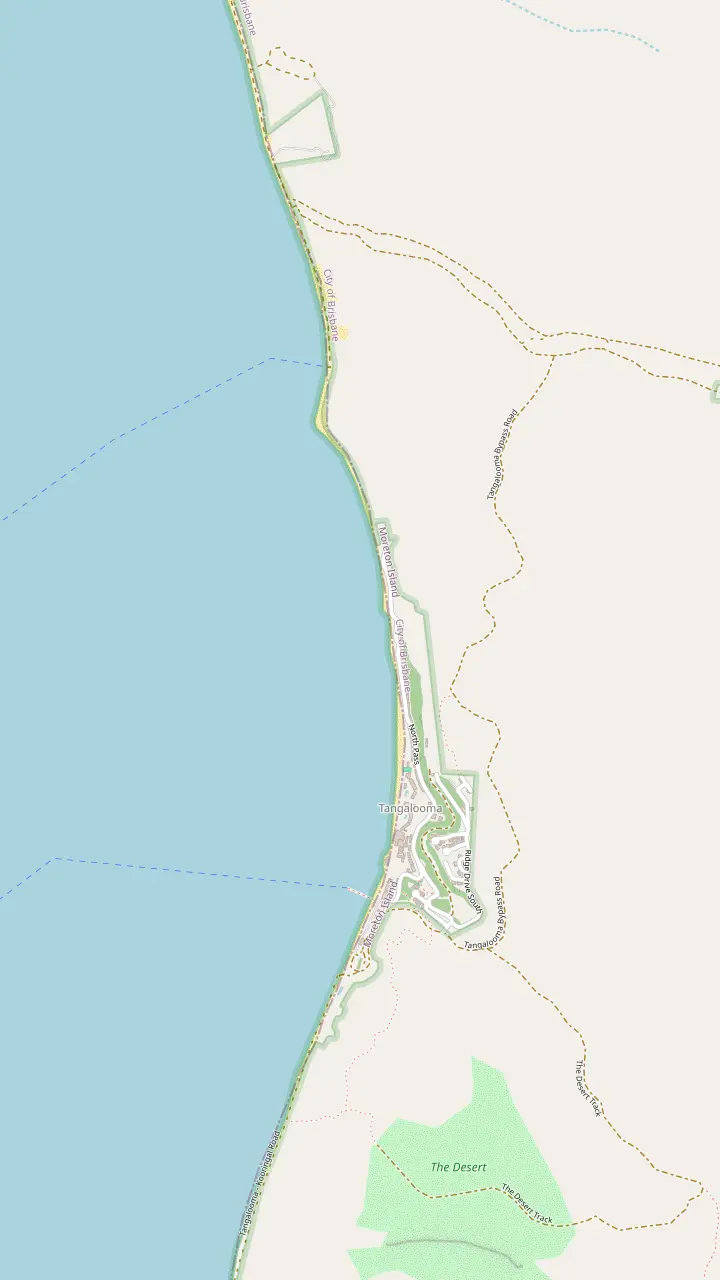
Pick a route and tap a pin or a stop: you get its note and a Google Maps link.
The Gold Coast shuttle pickups begin at 6:35AM, starting at The Star Gold Coast.
Google MapsThe Micat departs from 14 Howard Smith Dr, Port of Brisbane.
Google MapsPassenger ferries leave Holt Street Wharf in Pinkenba and take 75 minutes each way.
Google MapsA Sunday passenger launch for walk-on passengers runs from Redcliffe Jetty to Bulwer.
Google MapsBribie Island is the only Queensland island accessible by bridge.
Google MapsAll water taxis and ferries to North Stradbroke Island leave from Cleveland.
Google MapsDunwich is the gateway to North Stradbroke Island by ferry and water taxi.
Google MapsCoochiemudlo is covered with the Southern Moreton Bay Islands of Macleay, Lamb, Karragarra, Russell and Peel.
Google MapsPassenger ferries land at the Tangalooma jetty after 75 minutes.
Google Maps
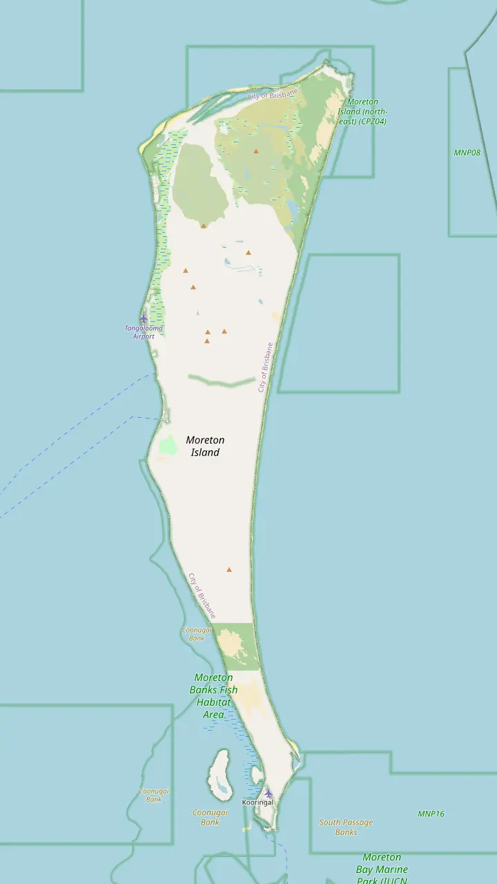
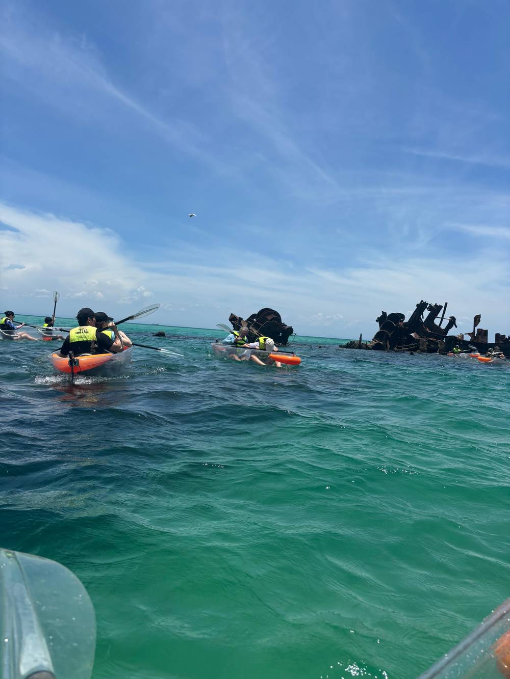
Visit Brisbane describes the wrecks as a group of 15 ships sunk in 1963.
Google MapsTangalooma is a private resort, and casual visitors are not permitted entry.
Google MapsThe Desert is an active dune area south of Tangalooma.
Google MapsVehicle access is prohibited on the beach at Cowan Cowan township.
Google MapsDriving from Tangalooma to Bulwer via Cowan Cowan takes 35 min.
Google MapsThe Blue Lagoon track is easy, 500 m return, and takes 20 min.
Google MapsMount Tempest reaches 285 m and is thought to be the highest stabilised sand dune in the world.
Google MapsCape Moreton has Queensland's first lighthouse, built in 1857.
Google MapsThe Rous Battery track is 9.8 km one way.
Google MapsThe Amity Trader runs from Victoria Point on the mainland to Kooringal.
Google Maps
Public toilets stand at the Wrecks campground, a 5 minute walk from where the ferry lands.
Google MapsThe wrecks lie approximately 200 m off the beach.
Google MapsThe dolphins arrive for their nightly feed at dusk and swim up alongside the jetty.
Google MapsVehicle access is prohibited on the beach at Tangalooma Resort.
Google MapsThe Desert walk is a moderate 4 km circuit.
Google MapsBen-Ewa campground sits in a valley with shady sites.
Google Maps
© OpenStreetMap contributors, map data
Brisbane's bay holds sand islands, a bridge island and a string of small ones. This page sets their size, crossings and character side by side and shows where each sits on the map.
Editorial team, moretonislanddaytrip.com · Updated November 7, 2026 · 7 min of reading
In brief
- Moreton IslandA wedge of sand 37 km long and 10 km wide, 40 km from central Brisbane.1
- North Stradbroke30 km southeast of Brisbane, about 38 km long and 11 km wide.2
- Bribie IslandReached by a bridge, just over an hour from Brisbane.3
- Southern islandsMacleay, Lamb, Karragarra, Russell and Peel, plus nearby Coochiemudlo.4
- The marine parkMoreton Bay Marine Park was declared in 1993 and surrounds Moreton Island.5
What the Moreton Bay islands are
The Moreton Bay islands are the sand and bay islands that sit between Brisbane and the open Pacific. The island manager describes Moreton Island, with North Stradbroke and South Stradbroke islands, as the eastern boundary of Moreton Bay, a large, shallow, biologically diverse expanse of water.6 Bribie Island closes the bay to the north, and Redland City's group of small islands lies in its southern reaches, closer to the mainland shore.
Visit Redlands Coast covers nearby Coochiemudlo Island together with the southern bay group of Macleay, Lamb, Karragarra, Russell and Peel Islands.4 Those are the names behind the question of which islands make up the southern group, and they are small bay islands rather than ocean sand islands. The big ones, Moreton and Stradbroke, face the open ocean on one side and the shallow bay on the other.
How big is Moreton Bay? Tangalooma's account of the marine park, which protects the bay's habitats, gives 125 km of coastline from the Gold Coast to Caloundra and 3400 square kilometres.7 The island manager adds that the Moreton Bay Marine Park was declared in 1993 and surrounds Moreton Island.5 Treat those as park figures rather than a survey of the open water, and expect other sources to quote different totals for the bay itself. For planning a day, the island sizes and the crossing times matter more than the bay's area.
Side by side
Island groups compared
| Island | Size or position | How you reach it | Known for |
|---|---|---|---|
| Moreton Island | 37 km by 10 km1 | Ferry from the Port of Brisbane or Holt Street Wharf9,11 | Wrecks, dunes and Mount Tempest16,17 |
| North Stradbroke | About 38 km by 11 km2 | Water taxi or ferry from Cleveland8 | Surf and headland whale watching19,20 |
| Bribie Island | Just over an hour from Brisbane21 | By bridge3 | Beach driving and national park22,23 |
| Southern bay islands | Macleay, Lamb, Karragarra, Russell, Peel4 | Check Redlands Coast | Sheltered swimming and secluded beaches24 |
Facts come from the island manager, regional tourism sites and the resort named; listing prices on this page are from prices.
Moreton Island, the sand island with the wrecks
Moreton Island is a wedge-shaped sand island 37 km long and 10 km wide, located 40 km from central Brisbane.1 Visit Brisbane calls it the world's third largest sand island,12 and Tangalooma agrees that it is the third largest sand island in the world and that it consists entirely of sand, apart from a small area of sandstone and rhyolite at Cape Moreton.13 Most of the island, 19,000 ha excluding townships, is both national park and recreation area.14
The island is a destination for what it does not have. There are no bridges and no sealed roads, and the only access is by boat.15 Passenger ferries take 75 minutes each way from Holt Street Wharf, while the Micat vehicle ferry takes approximately 90 minutes from the Port of Brisbane.9,10 A visitor should plan the day around that boat, since every journey to the sand begins and ends on the water, and the last boat home fixes the end of the day.
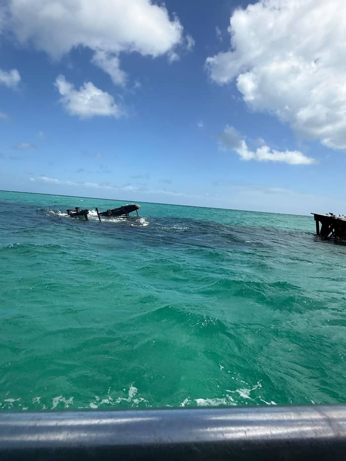
Its calling cards are the wrecks, the dunes and the wildlife. Visit Brisbane describes the Tangalooma Wrecks as a group of 15 ships sunk in 1963,16 Mount Tempest rises 285 m and is thought to be the highest stabilised sand dune on earth,17 and over 180 species of birds have been recorded.18 The site tour in this guide is built on exactly those: it lists snorkelling around the wrecks, sand tobogganing in The Desert and 4WD driving along the beach.
Sizes in kilometres
The big islands in numbers
North Stradbroke, called Straddie
North Stradbroke Island, known as Straddie or Minjerribah, is located 30 km southeast of Brisbane and is the world's second largest sand island, about 38 km long and 11 km wide.2 It covers an area of 275.2 km2.26 Its own tourism site says Straddie has the closest surf to Brisbane City, and it calls Point Lookout popular for surf beaches, land-based whale watching from the headland and the North Gorge walk.19,20
Getting there differs from Moreton. All water taxis, passenger ferries and vehicle ferries to the island leave from Cleveland.8 Cleveland is 30 km from the Brisbane CBD via Old Cleveland Road, an estimated 50 minutes of driving, and 78 km from the Gold Coast via the Pacific Motorway, an estimated 1 hour and 20 minutes.25,27 Sealed roads connect the 3 townships of Dunwich, Amity and Point Lookout, so roads link the townships, in contrast to the sand tracks of Moreton Island.28
Wildlife is part of the draw. The waters around Straddie contain 6 of the world's 7 species of marine turtles, and Moreton Bay Marine Park supports the southernmost population of dugong in Australia.29,30 A guided Straddie wildlife day from Brisbane is listed at 10 hours, limited to 11 participants, with 994 reviews and a rating of 4.8. It sits in a different corner of the bay from the wrecks, to the south, and would be a separate trip from a Moreton day. Check the group size and the pickup point on the booking page.
Pick your island
Which bay island suits you?
Start from what you want to see and read across to the island.
If I want shipwrecks and big dunes
Moreton Island
Visit Brisbane describes the wrecks as 15 ships sunk in 1963, and Mount Tempest reaches 285 m.16,17
If I want surf and a headland for whales
North Stradbroke
Straddie has the closest surf to Brisbane City, and Point Lookout offers land-based whale watching.19,20
If I want to drive onto an island
Bribie Island
It is reached by a bridge, and 4WD adventures begin at Woorim.3,23
If I want sheltered swimming
The southern bay islands
Redlands Coast describes sheltered swimming, secluded beaches and golden sunsets there.24
If I only have a single day
Weigh the crossings
Moreton needs 75 to 90 minutes by boat, while Straddie needs an estimated 50 minutes of road to the Cleveland ferries.9,10,25
Islands and days
A day trip for each big island
Bribie, the island with a bridge
Bribie Island is reached by a bridge.3 Visit Moreton Bay describes it as a stunning island escape just over an hour from Brisbane, in the region the tourism body names after the bay.21 A bridge changes the planning: there is no ferry timetable, no boarding pass and no wait for a boat, so the island feels like an extension of the mainland drive more than an expedition. That suits a driver with an afternoon to spare, and it suits a family who would rather not time a boat, though the beach tracks still ask for a capable vehicle.
Much of the wild side is in the north. Bribie Island National Park and Recreation Area occupies much of the northern section of the island, and many camping areas are only accessible by high-clearance four-wheel-drive vehicles.22,48 Most 4WD adventures begin at Woorim on the eastern side.23 For a day without your own vehicle, a Bribie day trip and 4x4 tour from Brisbane is listed at 9 hours, rated 4.7 from 19 reviews.
Bribie sits on the northern side of the bay. Redcliffe lies on the same side of the bay, a 30 minute drive from Brisbane Airport,49 and the Sunday walk-on launch from Redcliffe Jetty goes to Bulwer on Moreton Island at 10am, returning at 4pm.33 The northern bay thus ties Bribie and Moreton together on the map, although few trips cross between them, and the map at the top of this page shows how the pieces fit.
Work out the bill
Compare the island days
Set your party size and read off the from price of each day.
3 options compared
Compare the island days
Set your party size and read off the from price of each day.
- Moreton day1 day · per person, from $126
≈
View - Straddie wildlife10 hours · per person, from $104
≈
View - Bribie 4x4 day9 hours · per person, from $174
≈
View
From-prices on GetYourGuide, shown at the ECB reference rate. Your exact price is confirmed during booking.
Crossings
Ways onto an island
By bridge
Bribie Island
Bribie Island is reached by a bridge.3
By water taxi
North Stradbroke
All water taxis, passenger ferries and vehicle ferries to the island leave from Cleveland.8
By passenger ferry
Tangalooma
The passenger ferry from Holt Street Wharf takes 75 minutes each way.9
By vehicle ferry
Moreton Island
The Micat takes approximately 90 minutes from the Port of Brisbane and carries vehicles.10,11
The southern bay islands
Redlands Coast describes its bay islands as places for peaceful escapes shaped by island life, with sheltered swimming, secluded beaches and golden sunsets.24 The islands are Macleay, Lamb, Karragarra, Russell and Peel, and nearby Coochiemudlo Island.4 They suit a quiet afternoon more than a day of wrecks, dunes and boats. Anyone searching for the southern Moreton Bay islands is usually looking for exactly that slower pace, close to the mainland shore.
The sources used here give names and character for these islands, not timetables, so this page makes no promises about ferries or tours to them. If the southern islands are your target, check the Redlands Coast site for the current services. The comparison table further down fixes sizes and crossings only for the three large islands, and leaves the southern group as a line to follow up.
Where the large islands face the ocean, the southern ones face the bay. That is the practical difference between the groups: a bay island is calmer, smaller and quieter, and you reach it with a different ferry from a different port. For a visitor to Brisbane with a single day, the large islands offer more set-piece sights, and the southern islands offer a gentler pace. Pick by temperament as much as by distance, and let the quiz and the table narrow the choice.
Video
Moreton Island versus North Stradbroke Island: which is better to visit
Aquarius Traveller on YouTube · The video stays unloaded until you press play.
As the third largest sand island in the world, Moreton Island consists entirely of sand, apart from a small area of sandstone and rhyolite at Cape Moreton.
Before you choose
Questions to settle first
Time and crossing3
Choosing one for a day trip
The question is what you want to see. Wrecks, dunes and a guided programme point to Moreton Island, where the site tour is a full-day trip from Brisbane or the Gold Coast, from $126, with free cancellation up to 24 hours in advance. Surf, a headland and turtle waters point to Straddie, whose wildlife day is listed from $104. A drive-on beach and a bridge point to Bribie, whose 4x4 tour is listed from $174.
Distance and time matter too. Moreton is 40 km from central Brisbane and Straddie is 30 km southeast of it,1,2 but the crossing times differ: 75 minutes by passenger ferry to Tangalooma, and an estimated 50 minutes of road to the Cleveland ferries before a water taxi or ferry crossing begins.9,25 A day to Moreton spends more of its hours on the water, and a day to Straddie spends more of them on the road, which is worth knowing when you compare the listed lengths of the days.
These are not rivals so much as three different days. Many visitors will do one this trip and another on the next, and the map at the top of this page shows where each one lies, from the Port of Brisbane in the west to the bay's farthest pins. The table, the cards and the quiz help you settle on the right one for the time you have, and the listings keep their free cancellation lines for the day the forecast changes.
FAQ
Fast answers to common questions.
Which islands lie in Moreton Bay?
Which are the southern bay islands?
What area does the bay's marine park cover?
3400 square kilometres.
Tangalooma gives 125 km of coastline from the Gold Coast to Caloundra and 3400 square kilometres for the marine park.7
How big is Moreton Island?
37 km by 10 km.
It is a wedge of sand 37 km long and 10 km wide, located 40 km from central Brisbane.1
How big is North Stradbroke Island?
Is there a bridge to any of the islands?
Yes, to Bribie Island.
Bribie Island is reached by a bridge.3
How do I get to North Stradbroke Island?
Which island has the wrecks?
Moreton Island.
Visit Brisbane describes the Tangalooma Wrecks as a group of 15 ships sunk in 1963.16
Sources
- Mulgumpin Camping (Quandamooka Yoolooburrabee Aboriginal Corporation) · Natural environment ↩
- North Stradbroke Island official information site · About Stradbroke ↩
- Visit Moreton Bay (Tourism and Events Moreton Bay) · Bribie Island ↩
- Visit Redlands Coast (Redland City Council) · Southern Moreton Bay Islands ↩
- Mulgumpin Camping (Quandamooka Yoolooburrabee Aboriginal Corporation) · Natural environment ↩
- Mulgumpin Camping (Quandamooka Yoolooburrabee Aboriginal Corporation) · Natural environment ↩
- Tangalooma Island Resort (official site) · Where is Tangalooma Island Resort ↩
- North Stradbroke Island official information site · Getting here ↩
- Tangalooma Island Resort (official site) · Launch transfer times and information (ferries) ↩
- Moreton Island Adventures (Micat ferry operator) · Micat Moreton Island ferry ↩
- Mulgumpin Camping (Quandamooka Yoolooburrabee Aboriginal Corporation) · Getting there ↩
- Visit Brisbane (Brisbane Economic Development Agency) · Moreton Island ↩
- Tangalooma Island Resort (official site) · Where is Tangalooma Island Resort ↩
- Mulgumpin Camping (Quandamooka Yoolooburrabee Aboriginal Corporation) · Natural environment ↩
- Tangalooma Island Resort (official site) · Personal 4WD vehicle access and parking ↩
- Visit Brisbane (Brisbane Economic Development Agency) · Moreton Island ↩
- Mulgumpin Camping (Quandamooka Yoolooburrabee Aboriginal Corporation) · Natural environment ↩
- Mulgumpin Camping (Quandamooka Yoolooburrabee Aboriginal Corporation) · Natural environment ↩
- North Stradbroke Island official information site · Straddie home ↩
- North Stradbroke Island official information site · Straddie home ↩
- Visit Moreton Bay (Tourism and Events Moreton Bay) · Bribie Island ↩
- Visit Moreton Bay (Tourism and Events Moreton Bay) · The Ultimate Guide to Camping and 4WDing on Bribie Island ↩
- Visit Moreton Bay (Tourism and Events Moreton Bay) · The Ultimate Guide to Camping and 4WDing on Bribie Island ↩
- Visit Redlands Coast (Redland City Council) · Southern Moreton Bay Islands ↩
- North Stradbroke Island official information site · Getting here ↩
- North Stradbroke Island official information site · About Stradbroke ↩
- North Stradbroke Island official information site · Getting here ↩
- North Stradbroke Island official information site · Getting here ↩
- North Stradbroke Island official information site · About Stradbroke ↩
- North Stradbroke Island official information site · About Stradbroke ↩
- Tangalooma Island Resort (official site) · Bus and coach transfers
- Moreton Island Adventures (Micat ferry operator) · Micat Moreton Island ferry
- Mulgumpin Camping (Quandamooka Yoolooburrabee Aboriginal Corporation) · Getting there ↩
- North Stradbroke Island official information site · Straddie home
- Tangalooma Island Resort (official site) · Casual visitor access policy
- Mulgumpin Camping (Quandamooka Yoolooburrabee Aboriginal Corporation) · Natural environment
- Mulgumpin Camping (Quandamooka Yoolooburrabee Aboriginal Corporation) · Staying safe
- Mulgumpin Camping (Quandamooka Yoolooburrabee Aboriginal Corporation) · Staying safe
- Mulgumpin Camping (Quandamooka Yoolooburrabee Aboriginal Corporation) · Things to do and see
- Mulgumpin Camping (Quandamooka Yoolooburrabee Aboriginal Corporation) · Things to do and see
- Mulgumpin Camping (Quandamooka Yoolooburrabee Aboriginal Corporation) · Things to do and see
- Mulgumpin Camping (Quandamooka Yoolooburrabee Aboriginal Corporation) · Getting there
- Moreton Island Adventures (Micat ferry operator) · DIY day tour
- Moreton Island Adventures (Micat ferry operator) · DIY day tour
- Tangalooma Island Resort (official site) · Frequently asked questions
- Mulgumpin Camping (Quandamooka Yoolooburrabee Aboriginal Corporation) · Things to do and see
- Mulgumpin Camping (Quandamooka Yoolooburrabee Aboriginal Corporation) · Campgrounds
- Visit Moreton Bay (Tourism and Events Moreton Bay) · The Ultimate Guide to Camping and 4WDing on Bribie Island ↩
- Visit Moreton Bay (Tourism and Events Moreton Bay) · Redcliffe ↩
Read next